A cell site visit ends with a folder of photos and a spreadsheet of numbers: three sector azimuths, three down-tilts, two serial numbers, a grounding bar, a dozen connectors. Back at the office, someone has to work out which antenna photo belongs to which sector, retype serials from blurry label shots and answer the operator's question: "Was the tilt really 4°?" A telecom site audit app should capture the reading, the photo and the site in one step, so the audit pack builds itself while you're still on the tower.
This guide shows how to run BTS and cell site audits with ProofCam: AngleCam photos for azimuth and tilt, the bundled BTS site audit checklist, on-device text recognition for RRU/BBU serials, and exports your client can open in Google Earth.
Why cell site photo packs go wrong
- Photos without context. A close-up of an antenna doesn't say which sector, which site or which way it pointed. Twenty similar photos from five sites end up in one chat thread.
- Readings and photos live apart. Tilt is read off an inclinometer and written in a notebook. The photo that should back it up was taken a minute later, from a different angle.
- Serial numbers get retyped. RRU and BBU labels are small, high on the mast and often dirty. One wrong character breaks the asset register.
- No signal on site. Rural sites and equipment shelters often have weak coverage, so photos sit unsent, or get sent late and lose their time context.
- Rework disputes. When an operator rejects a site for a missing weatherproofing photo, the team climbs again. A clear, timestamped record of what was checked avoids a lot of second climbs.
Which ProofCam features help with a telecom site audit
| Need | ProofCam feature | Plan |
|---|---|---|
| Time, GPS, address and heading on every photo | Watermark with network time and true-north compass | Free |
| Tilt, roll and azimuth printed on antenna photos | AngleCam (live readout with artificial horizon) | Telecom pack: Plus, a trial team, or Business with the telecom add-on |
| Ready-made audit forms | Bundled BTS site audit (scored, pass 90%) and Fiber splice / route templates | Telecom pack (as above) |
| Site panorama | Compass-guided 4-direction set N/E/S/W with 2×2 collage | Plus |
| RRU/BBU serial numbers | On-device text recognition from photo details; OCR in document mode | Free in photo details · document mode Plus |
| Centimeter positions and laser distances | External Bluetooth RTK GNSS receiver and laser meter | Business (or trial) |
| Proof the photo is the original | Photo Code + web verify page | Free |
| Sites with no coverage | Offline capture, Sync center | Free |
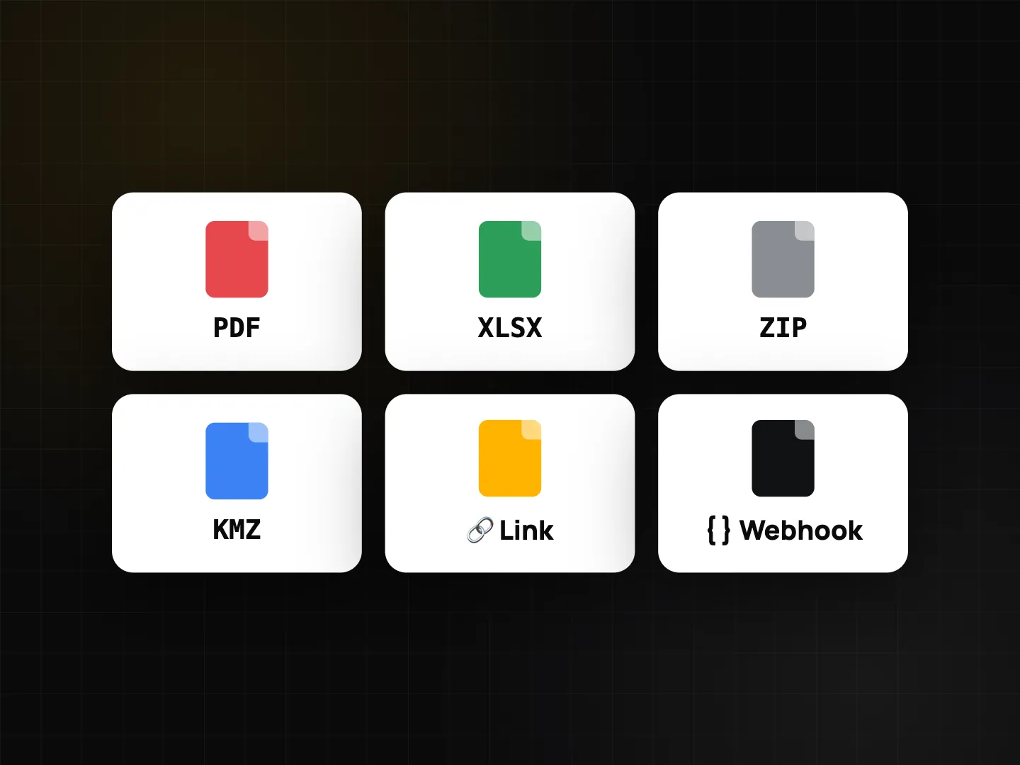
| Site map for the client | KMZ export for Google Earth, PDF, Excel | Free (10 photos per export) · Plus unlimited |
AngleCam: what it reads and what it doesn't
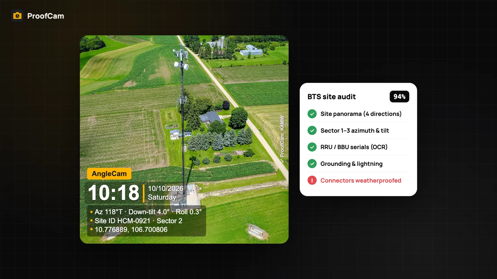
Turn on AngleCam from the camera's antenna button. The viewfinder shows an artificial horizon, a crosshair and a live readout of down-tilt, roll and azimuth (true north). When you take the photo, the title becomes "AngleCam" and the three values are printed on the watermark next to the time, GPS and Photo Code.
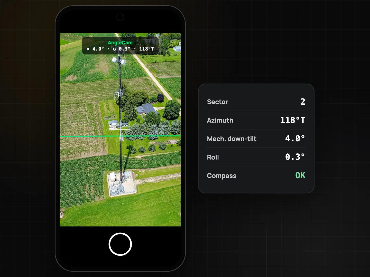
Be clear about what this is: readings from the phone's own motion sensors and magnetometer. Tilt and roll describe how the phone is held, so for an antenna reading, line the phone up with the antenna or its bracket the way your method statement describes. The compass is affected by steel, so:
- calibrate when ProofCam shows the figure-eight prompt (it appears whenever magnetometer accuracy is low);
- take azimuth readings a few meters away from the mast and the cabinet where you can;
- if the compass is unreliable, ProofCam leaves the heading off rather than printing a wrong number.
If the operator's contract specifies a calibrated inclinometer, a compass or a dedicated antenna alignment tool, use it. AngleCam then documents the scene and backs up the instrument reading you type into the checklist. It doesn't replace that instrument.
Step-by-step workflow
- Set up the project. Create a project per site or per batch (for example "HCM-0921"). Add the site address and radius. With Plus, ProofCam selects the project automatically when you arrive inside that radius.
- Install the template. Open Checklists and add BTS site audit from the telecom pack. For fiber work, add Fiber splice / route too.
- Arrive and record the site. Fill in the site ID and GPS. Shoot the 4-direction panorama (Plus): ProofCam guides you N → E → S → W and only fires within 10° of each direction.
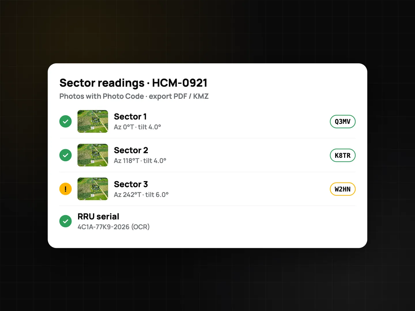
- Sector by sector. For each sector, take the AngleCam photo, then enter the azimuth and mechanical down-tilt you measured into the number fields (0–360° and -20° to 20°). The template keeps the photo and the numbers together per sector.
- Equipment. Photograph the RRU and BBU labels, open photo details and tap text recognition. Copy the serial into the required serial field, then check it against the label. Worn stickers and reflections can produce wrong characters. More on this in document scanning and on-device OCR.
- Pass/fail items. Grounding and lightning protection, cable labels, connector weatherproofing, power and battery backup, site clean: each is Pass / Fail / N/A with a required photo. A Fail is flagged and lowers the score. The audit passes at 90%.
- Sign and finish. The template asks for a signature. Generate the PDF on the phone, with every photo's Photo Code and a verify QR. If there is no signal, everything is saved and syncs later from the Sync center.
- Office and client. Export KMZ so the client sees each photo pinned on the site in Google Earth, plus PDF or Excel for the records. In a Teamspace, the manager reviews the submission in the web portal and approves or rejects it.
External RTK GNSS and laser meters
When the client asks for centimeter-level site coordinates, a Business team (or trial) can connect a Bluetooth RTK GNSS receiver with NTRIP corrections. While the receiver has a fresh fix, its position replaces the phone's on the photo, with a line such as "RTK FIXED ±0.02 m". Laser distance meters can type their readings into ProofCam too.
Platform matters here. Android supports Bluetooth Classic (SPP) and BLE receivers. iPhone only supports BLE serial receivers or accessories that feed iOS Location Services, so check your receiver before a field day. Details are in field meters, RTK GNSS and laser readings. For phone GPS quality, the location trust grade shows how much to trust a fix (full grading on Android, a basic check on iPhone).
BTS site audit checklist (template contents)
| Section | Item | Question type |
|---|---|---|
| Site | Site ID | Text, required |
| Site GPS | GPS location | |
| Site panorama, 4 directions | Photo, min. 4 | |
| Antennas | Sector 1–3 azimuth | Number, ° (0–360) |
| Sector 1–3 mechanical down-tilt | Number, ° (-20 to 20) | |
| Sector 1–3 antenna photo (AngleCam) | Photo | |
| Equipment | RRU and BBU serial numbers (OCR) | Text, required |
| Grounding & lightning protection | Pass / Fail / N/A + photo | |
| Cables labelled | Pass / Fail / N/A + photo | |
| Connectors weatherproofed | Pass / Fail / N/A + photo | |
| Power / battery backup | Pass / Fail / N/A + photo | |
| Closing | Site clean, no debris | Pass / Fail / N/A + photo |
| Remarks, signature | Text, signature |
The Fiber splice / route template covers route ID, start and end points, route photos (min. 3), closure tag by barcode, fibers spliced, maximum splice loss in dB, open tray and sealed closure photos, and an OTDR result item. You can copy either template and add your operator's own items, for example a sector 4 or a shelter temperature field. Checklist features are covered in inspection checklists with PDF reports.
Tips from the field
- One photo per reading. Take the AngleCam photo at the moment you note the value, so the number and the image match.
- Recalibrate between sites, and whenever you move from the ground to the platform.
- Use the Photo Code in your report. The operator can check any photo on the verify page. A copy sent through a chat app shows as "Modified copy", which is expected; the code still points to the original record.
- Keep the phone charged on long climbs. Offline capture works fine, but a dead phone doesn't.
Building a solar rooftop instead of a mast? See our guide to solar installation photo documentation.
FAQ
Is AngleCam accurate enough to replace an inclinometer?
No. It shows readings from the phone's sensors, which depend on how the phone is held and on compass calibration. Use it to document the antenna and back up readings, and use the client's specified instrument where the contract requires one.
Which plan do I need for AngleCam and the BTS template?
They're part of the telecom pack, which is unlocked by a personal Plus subscription, a team on the Business trial, or a Business team with the telecom add-on.
Can I audit a site with no mobile signal?
Yes. Photos, Photo Codes, checklists and PDFs all work offline. The data syncs when the phone is back online.
How does the client see the photos on a map?
Export a KMZ file and open it in Google Earth. Each photo appears at the location where it was taken. Free exports are limited to 10 photos; Plus has no limit.
Related: Photo Codes and verifying originals and offline photo proof.