Every team reads coordinates a little differently. The survey crew wants UTM eastings and northings, the defence contractor works in MGRS, the environmental consultant copies decimal degrees into a spreadsheet, and the landowner just wants something they can paste into a map app. If the stamp prints the wrong format, someone retypes numbers by hand, and that is where mistakes creep in.
ProofCam can print UTM and MGRS coordinates on photos, as well as decimal degrees, degrees-minutes-seconds (DMS) and an offline Plus Code. A separate field tool shows the distance and true bearing from where you stand to a target point and stamps them on the photo. This guide explains each format, where to set it, and what the numbers can and can't tell you.
Pick a coordinate format in the template
The format is part of your watermark template, so different projects can use different formats.
- Open the watermark template editor.
- Go to the Address section.
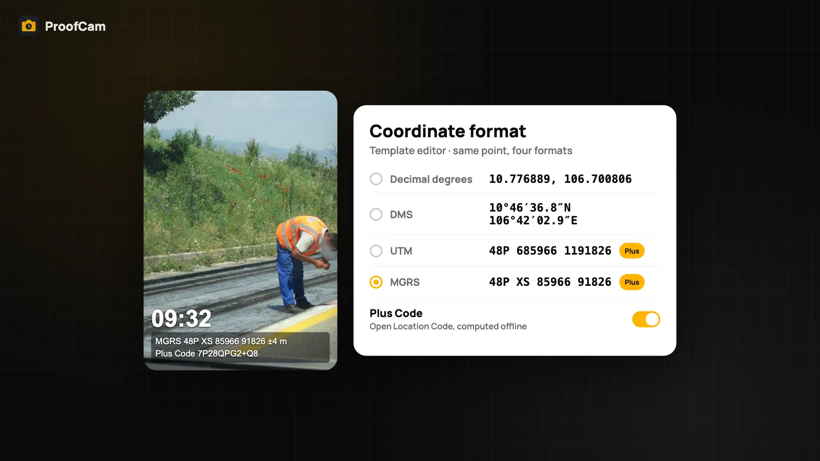
- Under Coordinate format, choose Decimal, DMS, UTM or MGRS.
Decimal and DMS are free. UTM and MGRS need Plus. If a template set to UTM or MGRS is used on the Free plan, for example after a colleague shares it with you, the stamp falls back to decimal degrees rather than showing nothing. The same options are in the template editor of the Teamspace web portal, so a manager can set the format once for the whole team. Templates in general are covered in watermark templates, styles and custom fields.
The same point in five formats
Here is one location printed in each format ProofCam supports:
| Format | Example | Plan |
|---|---|---|
| Decimal degrees | 10.776889, 106.700806 | Free |
| DMS | 10°46′36.8″N 106°42′02.9″E | Free |
| UTM | 48P 685966 1191826 | Plus |
| MGRS | 48P XS 85966 91826 | Plus |
| Plus Code | 7P28QPG2+Q8 | Free |
DMS vs decimal degrees
Both describe latitude and longitude. Decimal degrees are what spreadsheets, GIS tools and most map apps accept directly, so they are the safest choice when photos end up in Excel or a KMZ. DMS is easier to read aloud and matches older paper maps and many official forms.
UTM
UTM splits the world into zones and gives a position in metres: a zone (48P above), an easting and a northing. Because the units are metres, it is easy to estimate distances between two photos by subtracting the numbers. Survey and engineering crews often prefer it.
MGRS
MGRS is built on UTM but adds a 100 km square identifier (XS above) and shortens the digits. It is common in defence, emergency response and some utility work, where a short, unambiguous grid reference is read over a radio.
Plus Code
Turn on the Plus Code toggle ("Open Location Code, computed offline") to add a short code anyone can paste into a map app. With Short code + city, the stamp prints the shorter code with a nearby city name, which is easier to read out. It is computed on the phone, so it works without a signal. Plus Code is free and can sit next to any coordinate format.
WGS84 only: no national grids
All coordinates ProofCam prints are based on WGS84, the datum GPS uses. UTM and MGRS are WGS84 projections too. ProofCam does not convert to national grid systems such as Vietnam's VN-2000. If your contract or drawings use a national grid, keep the stamp in a WGS84 format and convert with your survey software. Do not compare a UTM number from the photo directly with a drawing in a different datum: the difference can be large.
Print a crosshair at the photo centre
The coordinates belong to the phone, not to the exact thing in the middle of the frame. To make clear what you were pointing at, turn on Print crosshair (free). It adds a thin crosshair and ring at the centre of the photo, so a reviewer can see which pole, manhole or sample point the photo was aimed at.
Crosshair and target: distance and bearing to a point
Sometimes you need to find a point rather than just record where you are: a planned pole location, a sampling station, a buried valve. The Crosshair & target tool in Field tools (on iPhone: Field tools → Target point) helps you walk there and prove you arrived.
- Set a target by typing its latitude and longitude with a label, or tap Use my current location to mark where you stand now.
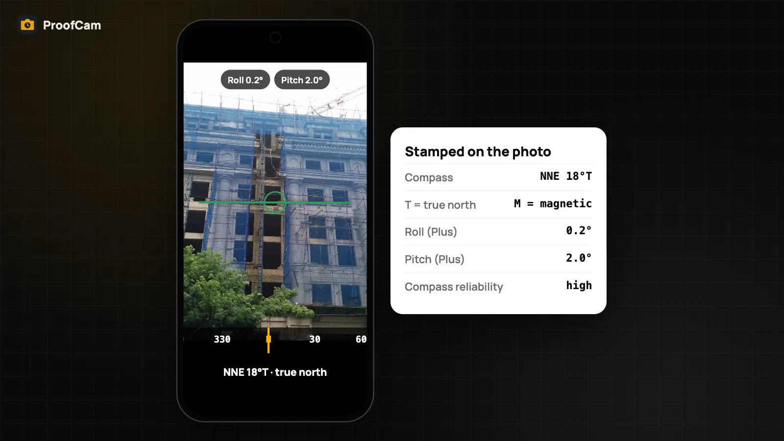
- The viewfinder shows a crosshair, the true bearing, the distance to the target and a turn arrow.
- Take the photo. The stamp gets a line such as "Target:
- Tap Clear target when you're done.
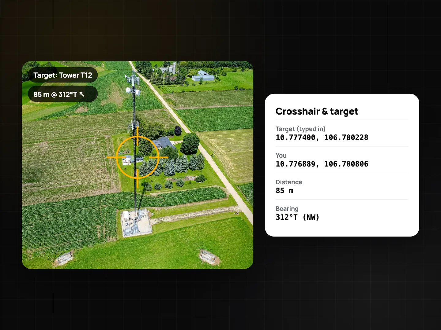
The tool works in photo mode and is free. The distance is a straight-line (great-circle) distance, which is fine for distances across a site. It is not a survey measurement: it depends on the phone's GPS and compass, both of which can be off near steel structures or under tree cover. For centimetre work, use a surveying instrument; ProofCam can stamp readings from external devices, as described in field meters, RTK GNSS and laser.
How accurate are the numbers?
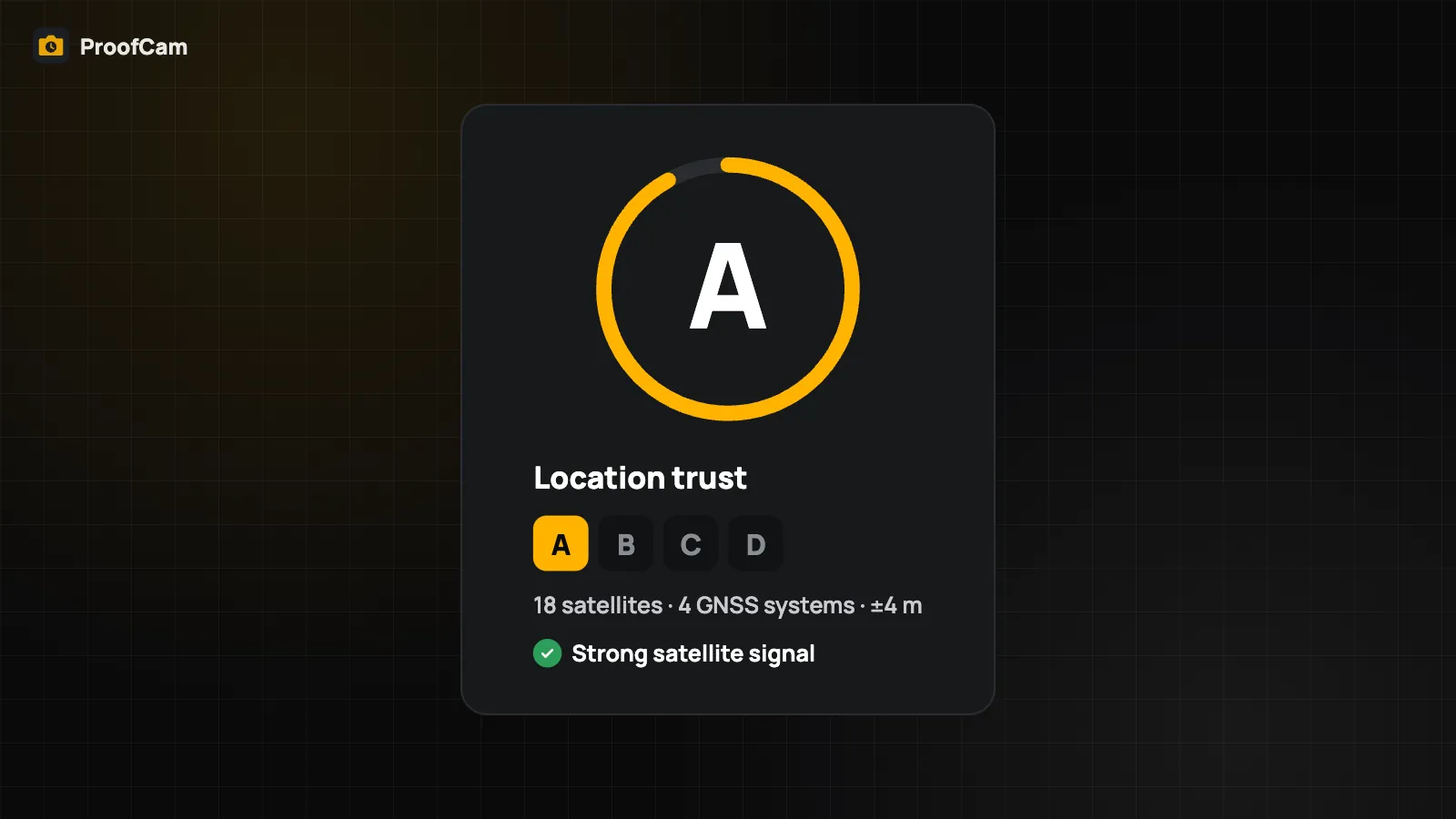
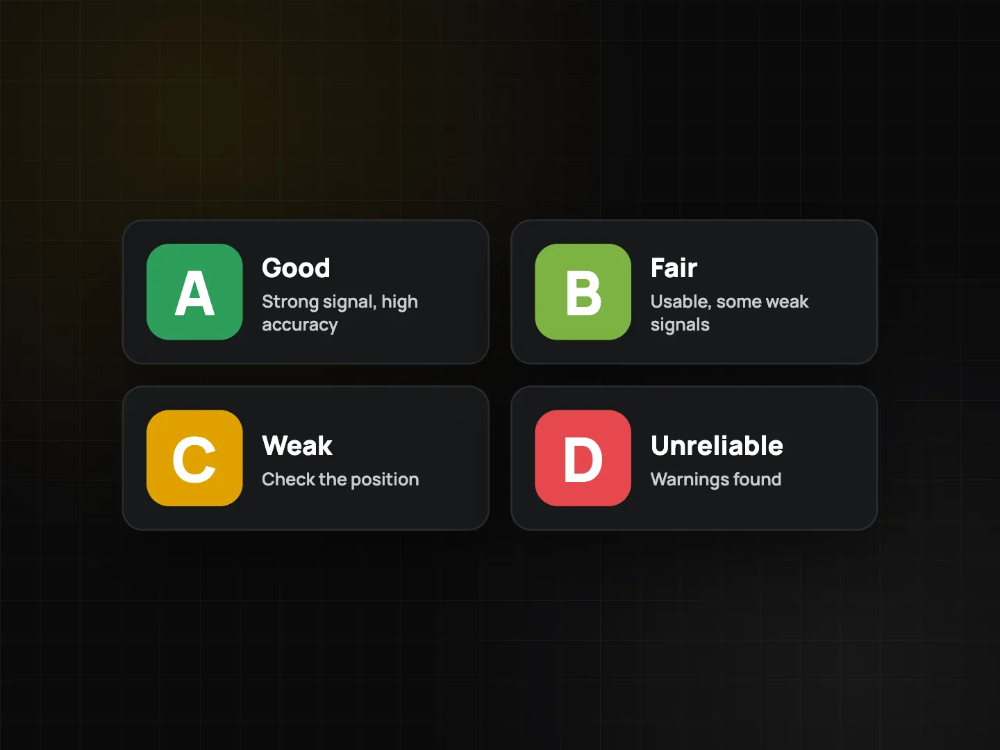
Printing a position in UTM to the metre doesn't make the position accurate to the metre. The precision of the format and the accuracy of the GPS fix are two different things. ProofCam gives each position a location trust grade from A to D, explained in GPS address, accuracy and location trust grade.
Practical tips:
- Wait a few seconds in the open sky before shooting a reference photo.
- Add the accuracy line to the template so the reviewer sees the uncertainty.
- Keep the same format across a project, so numbers in photos, exports and reports match.
Where each format fits
- Telecom site audits: UTM or decimal for the tower position, plus the target tool to confirm a planned site. See the telecom site audit guide.
- Environmental monitoring: decimal degrees for spreadsheets and KMZ, a crosshair on sample points. See the environmental site monitoring photo log.
- Road defects and public works: Plus Code with a city name for crews who share locations by phone; see road defect reporting.
- Farms: DMS or decimal to match land records.
Which plan and platforms
| Feature | Android | iPhone | Plan |
|---|---|---|---|
| Decimal, DMS | Yes | Yes | Free |
| UTM, MGRS | Yes | Yes | Plus |
| Plus Code, Short code + city | Yes | Yes | Free |
| Print crosshair | Yes | Yes | Free |
| Crosshair & target | Yes | Yes (Target point) | Free |
The coordinate format can also be set in the template editor of the Teamspace web portal at /app/.
FAQ
Can ProofCam print VN-2000 or other national grid coordinates?
No. All formats are based on WGS84. Use your survey software to convert to a national grid.
What happens to a UTM template on the Free plan?
The coordinates are printed as decimal degrees instead, so the photo still carries a usable position.
Is the target distance accurate enough for setting out?
No. It is a straight-line distance from the phone's GPS and compass, good for finding a point on site, not for setting out or surveying.
Does the Plus Code need internet?
No. It is calculated on the phone from the GPS position.
Related: camera with level and compass and floor level from the phone barometer.