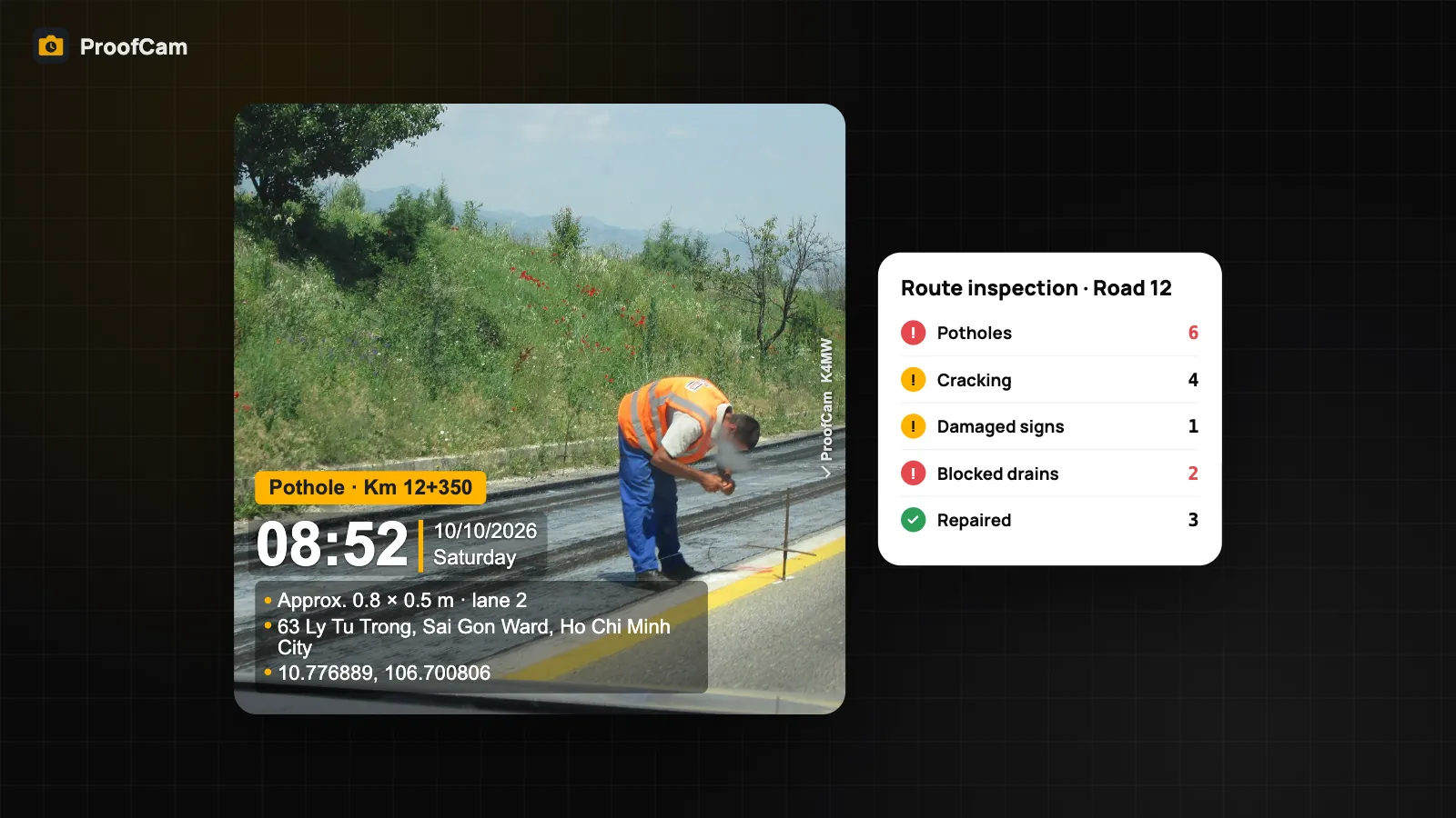
A road maintenance crew drives the same network every week, spots potholes, cracking, blocked drains and damaged signs, and has to prove two things to the road owner: where each defect was and when it was fixed. A phone photo in a chat group does neither reliably. This guide shows how inspectors and contractors can use ProofCam as a road defect reporting app: every defect photo stamped with time, GPS, address and a Photo Code, plotted on a map, and closed with an after photo from the same spot.
It's written for maintenance crews and contractors, not for residents reporting a pothole to the city.
What makes road defect reporting hard
- "Where exactly?" "Road 12 near the bridge" isn't a location. Crews need coordinates and a chainage (Km 12+350) the repair team can drive to.
- Disputed repair times. Contracts often set response times by severity. Without a trustworthy timestamp on the report and on the repair, every late item becomes an argument.
- Repairs that can't be matched. An after photo of fresh asphalt proves nothing if it might be a different pothole.
- Long routes, weak signal. Rural sections, tunnels and cuttings drop mobile data exactly where the work is.
- Reports that take longer than the inspection. Copying photos into a spreadsheet and drawing them on a map by hand eats the afternoon.
Which ProofCam features help
| Need | ProofCam feature | Plan |
|---|---|---|
| Defect photo with network time, GPS coordinates, address, accuracy | Timestamp camera | Free |
| Chainage, road, lane, defect type on every photo | Custom fields (Free 3, Plus 10) + notes and tags | Free / Plus |
| Show how reliable the position is | Location trust grade A–D (full on Android, basic check on iPhone), mock-location detection | Free |
| Check a photo is the original | Photo Code, verify on the web or offline | Free |
| Rough defect size | AR measure: distance and height (area is Plus), supported phones only | Free / Plus |
| Drive-by video of a section | Video with watermark (Free ≤ 15 s, Plus up to 10 min) + SRT/GPX sidecar | Plus for long video and sidecar |
| Structured inspection with photos and signature | Checklists + PDF | Free (1 template) / Plus / Business |
| Repair order with before/after proof and location check | Tasks (punch list) | Teamspace team |
| All defects on a map, daily routes, exports | Teamspace portal: map, PDF/XLSX/ZIP/KMZ, share links | Teamspace (Business for full limits) |
| Work without signal | Offline capture + Sync center | Free |
Geotagged defect photos you can trust
Each photo carries coordinates and an address, and you can add the GPS accuracy line to the stamp. Where no address lookup is possible, the coordinates are still on the photo. The location trust grade tells the reviewer how solid that position is: A means it looks reliable, D means it isn't, or a mock-location app was detected. On Android the check covers satellites and signal; on iPhone it's a basic check, and the app says so. See GPS address accuracy and location trust for the details.
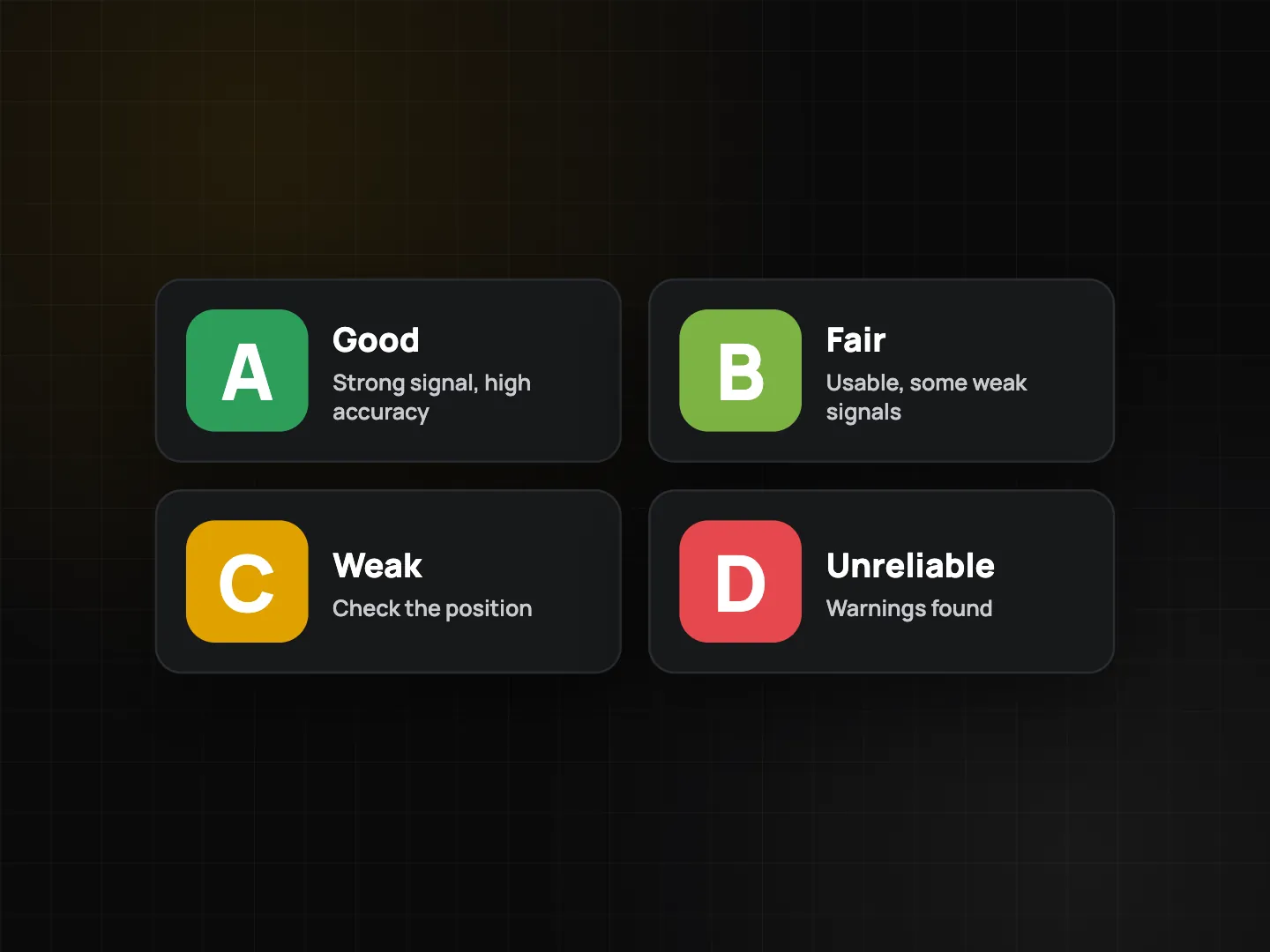
A Business team can block mock locations for everyone, so a defect can't be "reported" from the office.
Step-by-step workflow
Setup
- Create a Teamspace project per road or contract section, add the crew, and attach the network map or contract drawings as project documents.
- Build a watermark template from the Inspection preset with custom fields "Road", "Km" and "Lane". Make it the required team template.
- Agree on tags for defect types (pothole, cracking, rutting, drain, sign, guardrail) and severity (high, medium, low). Tags are searchable and filterable in the portal.
- Create a checklist for the route inspection (template below) and, on Business, turn on automatic tasks for flagged items.
On the route
- Photograph each defect with the road in context, then a close-up. Fill in Km and lane on the stamp; add a short note.
- Measure the size with AR measure on a supported phone: two distance readings give roughly 0.8 × 0.5 m. Treat it as an estimate; use a tape or measuring wheel when the contract needs exact quantities.
- Record a section on video if it helps: a passenger, not the driver, films from a mounted phone. With Plus, long videos and an SRT/GPX sidecar keep the time and track alongside the clip. Never handle the phone while driving.
- Create a task from the defect photo with assignee, due date and priority set by severity.
- No signal? Everything is saved on the phone and syncs later. See offline photo proof.
Repair and close
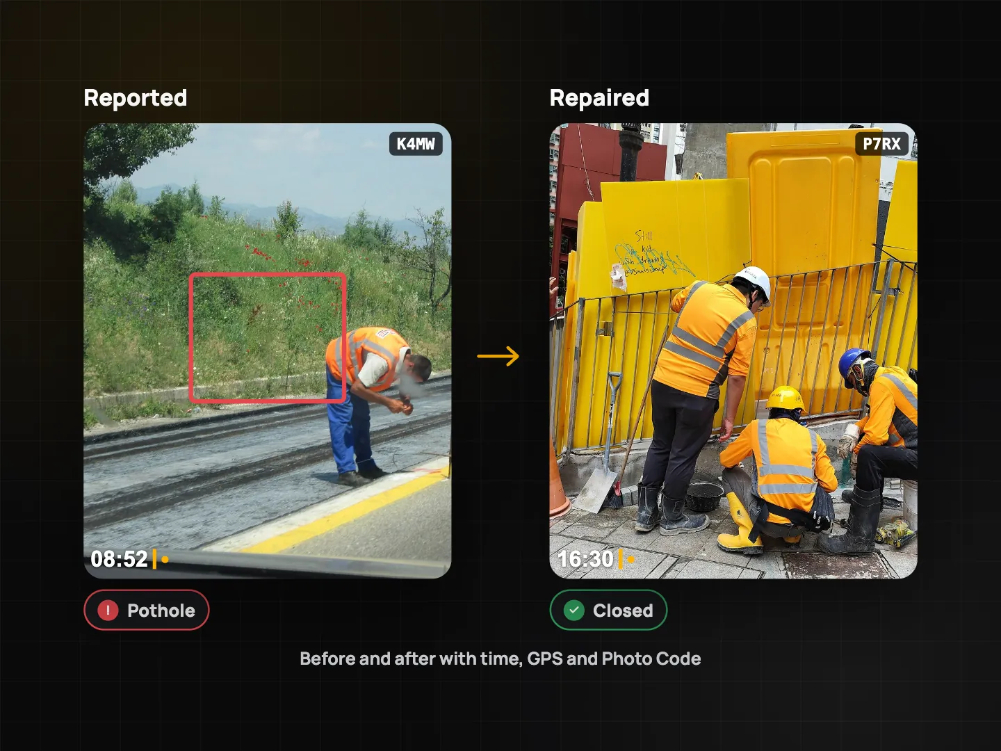
- The repair crew opens the task and taps Take after photo. The before photo appears at 30% opacity so they shoot the same spot.
- If the after photo is more than 50 m (team-adjustable) from the before photo, the task shows a red location warning for the reviewer.
- The supervisor checks before/after and closes or rejects the task. More on this in punch lists with before/after photos.
In the office
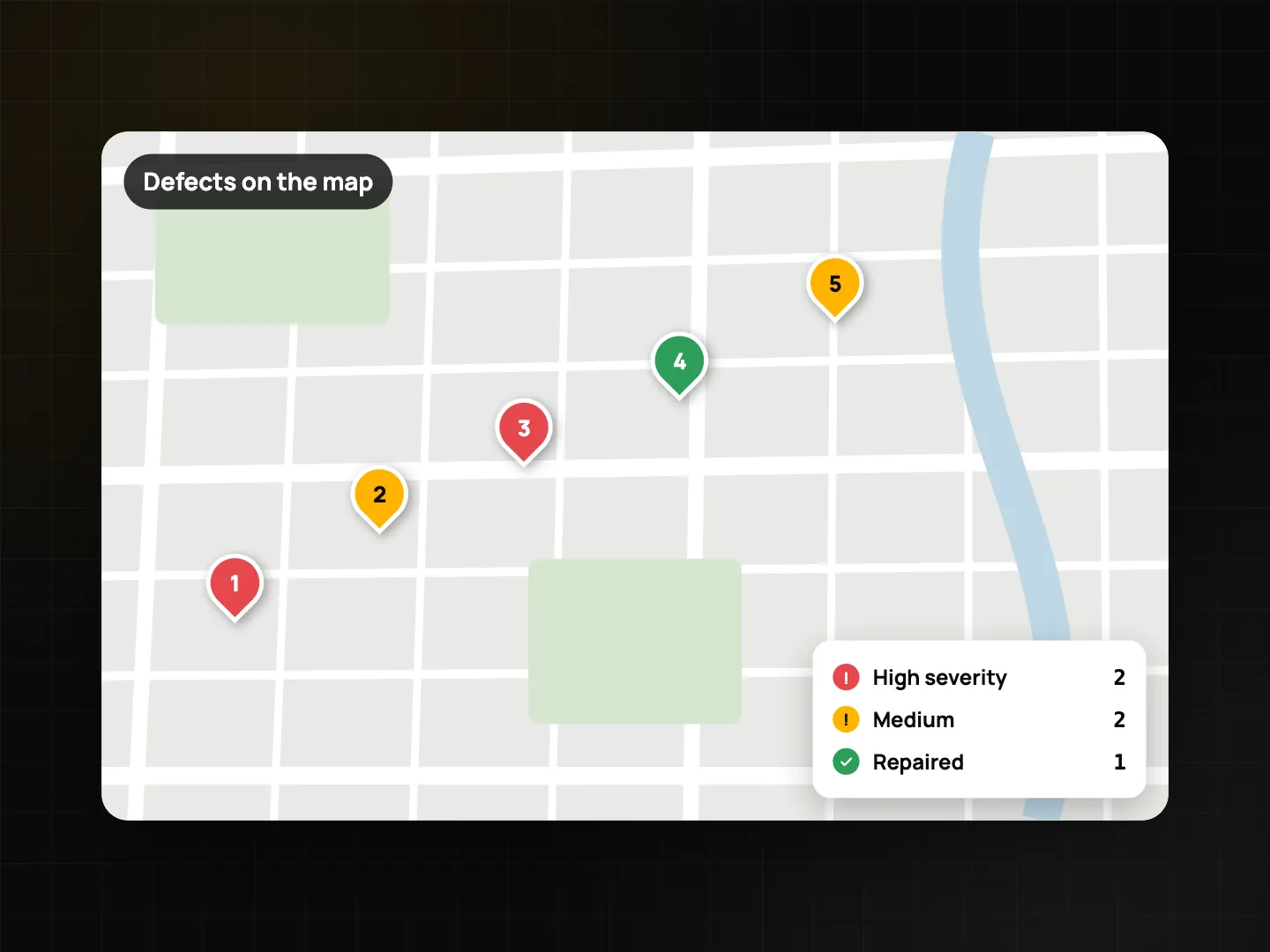
In the Teamspace web portal, photos appear as pins on a map and each inspector's daily route is drawn from their photos (no background tracking). Filter by tag to see open potholes on a section, export KMZ to open every defect in Google Earth, XLSX for the defect register, or a PDF for the road owner. A share link gives the client a photo grid and map without an account.
Route inspection checklist template
| Item | Question type |
|---|---|
| Road / section and direction | Single choice |
| Start and end chainage | Text |
| Weather and surface (dry / wet) | Single choice |
| Potholes found | Number + photo (min. 1 per defect) |
| Cracking or rutting | Yes / No + photo |
| Drains and culverts clear | Yes / No / N/A + photo (flag "No") |
| Signs and road markings readable | Yes / No + photo |
| Guardrails and barriers intact | Yes / No / N/A + photo |
| Hazard needing immediate action | Yes / No (flag "Yes" → task) |
| Defect location | GPS location |
| Inspector signature | Signature |
Score it if your contract rates sections, and use the PDF as the daily inspection record. Your road authority may prescribe its own defect categories, intervention levels and reporting format, so check its requirements and mirror them in the template.
Tips
- Shoot in the direction of travel first, then the close-up, so the repair crew recognises the spot.
- Keep the same tags all season. Filtering only works if "pothole" is always "pothole".
- Wait for a good grade before shooting on open roads with trees or cuttings; a few seconds in the open often improves it.
- Photograph the repair from the before position, using the ghost overlay.
For building sites, see the construction daily report app guide.
FAQ
Can residents use this to report potholes to the city?
ProofCam is built for crews and contractors who document their own work. Anyone can take a stamped photo, but it doesn't send reports into a city's complaint system.
How accurate is the pothole size from AR measure?
It's an estimate from the phone's AR, available only on supported phones. Use it for triage and photos, and measure by hand when quantities are billed.
Can I see all defects in Google Earth?
Yes. Export KMZ from the app or the Teamspace portal and open it in Google Earth; each photo appears at its location.
What if the repair crew takes the after photo somewhere else?
The task shows a red location warning with the distance when the after photo is farther from the before photo than the team's limit (50 m by default).
Related: timestamp camera for work proof and inspection checklists and PDF reports.